Read more at:
Google uses various colors to highlight key Google Maps user interface elements that users should pay attention to. For example, route suggestions are painted in shades of blue, with the main suggestion appearing in a dark blue. Similarly, the estimated time of arrival (ETA) can appear in different colors, which may not all be obvious. If you’ve ever seen the ETA indicator turn black, you may have been confused about what it means. However, black doesn’t always deliver bad news for your ETA, depending on where you see it. That’s because black ETAs can appear during both driving and transit modes. For driving, it’s simply an innocuous choice that may show up based on your display settings. It can also represent a lack of live data. For public transit, the color means the app isn’t receiving real-time updates about your current trip.
Google explained in January 2025 the meaning of the ETA color options in a Google Maps support forum in response to a user asking why the digits can appear in black and white. The response indicates the three colors that matter: green (for smooth traffic), orange (moderate traffic), and red (heavy traffic). This should offer quick visual guidance on the road ahead and the risk of delays. Black and white can appear to improve contrast in dark mode, or when there’s a lack of real-time traffic information, according to Google.
A different support document explains the colors and symbols Google uses for public transit navigation real-time data: green (on schedule), orange (early), and red (delayed). If you see ETAs in black, the transit navigation data is not receiving live updates. Finally, you may see a white exclamation point inside a red diamond for construction work and other delays.
How accurate are the Google Maps ETAs?
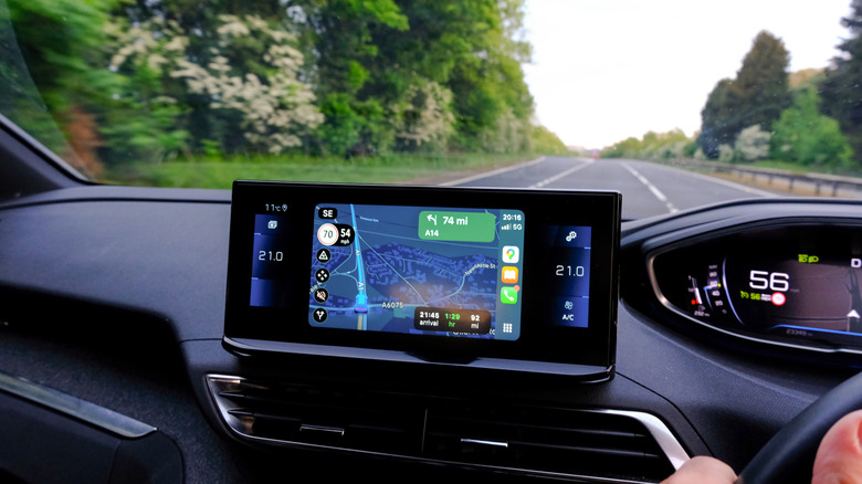
The ETA color choices are a key part of the Google Maps experience that can help the user make quick adjustments to their route based on this visual information, as long as they understand the UI colors. For example, seeing a red ETA in driving mode might prompt you to seek an alternative route to your destination to avoid potential delays. You may not always find one, but you’d at least be informed that you might be late. On the other hand, an orange ETA in public transit mode may tell you that the next bus or train is arriving early, and this can impact your travel time. You’ll have to hurry to catch it, or wait for the next option. It’s only when you see ETAs displayed in black and white that you might not be able to adjust your travel plans.
Google said in 2020 that it had partnered with the DeepMind AI research lab to improve the accuracy of its traffic prediction algorithms. Before the partnership, the Google Maps ETA predictions had been “consistently accurate for over 97% of trips,” according to the company. After using DeepMind AI data, Google has been able to further reduce the percentage of inaccurate ETAs.
Google also offered more details on how Google Maps suggests routes. The app takes into account various data points, including the quality and size of the road, historical traffic patterns (up to four weeks old), data from local governments (speed limits, tolls, and restrictions), and real-time information from other Google Maps users.
Can you change the ETA color schemes?

Google’s own ETA accuracy claims aside, it’s easy to check the data, especially if you drive along the same route often. You can start the application and see whether the ETAs it offers match the real-world driving experience. You can test public transit navigation ETAs similarly. Compare the actual travel time to the Google Maps predictions.
That said, you can’t change the ETA colors in the app, but you can try to avoid seeing black or white ETAs while driving. This may mean switching off dark mode on your handset to reduce the likelihood of seeing the digits in black or white. However, this may not be comfortable for driving at night. But ETAs can appear in black when the app can’t access real-time traffic information for both driving and transit modes. For example, using Google Maps for offline navigation may also lead to black ETAs, as the app would not have access to live traffic information. That’s speculation based on how Google explains the black and white color choices for the ETA UI.
When it comes to public transit navigation, you won’t be able to make changes to the ETA color scheme, as black indicates the app doesn’t have real-time information about the next bus or train you’re about to take. However, you can make changes to your route based on the ETA colors to try to avoid any delays that may be caused by heavy traffic or public transit disruptions.